Chapter 3 – The City of Burbank
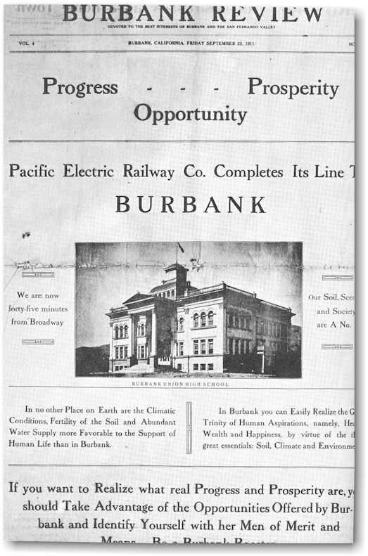
In 1911, two
events of outstanding importance occurred: the incorporation of Burbank as a
city and the completion of the Pacific Electric Railroad from Los Angeles to
Burbank. The business district had added a hardware store, a livery stable, a
dry goods store, a general store, a bicycle repair shop (which sold light
fixtures and sporting goods, did pipe fitting, and sold automobiles), and a
number of real estate offices because a second San Fernando Valley land boom
had started in 1905 and the people were beginning to buy property again.

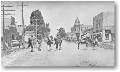
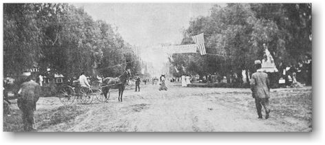
San Fernando Road between present day Angeleno and Orange Grove Avenues as it appeared in 1911.
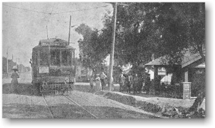
San Fernando Road and Verdugo Avenue, 1911.
Traffic was
no problem at the corner of San Fernando Road and Verdugo Avenue in 1911. There
were very few cars. Many people rode bicycles, others rode horses or used
horses and buggies.

The original
settlers who had stayed in Burbank and the few newcomers who had bought
property decided to make Burbank a city. The population was barely large enough
to ask the State Legislature to approve the incorporation and on July 8, 1911,
Burbank became a city of sixth class. The members of the Board of Trustees
selected to govern the city were F. A. Halburg, Thomas Story, Martin Pupka, J.
T. Shelton, and C. J. Forbes. The trustee elected Mr. Story the first mayor.
Mr. Story came to Burbank in 1880. He and his son had purchased the Goodenow
Hardware store on San Fernando Road. Ralph O. Church, the cashier at the Burbank
State, was chosen for city treasurer. J. A. Swall was city clerk, T. F. Ogier
became town marshal, and Charles Salisbury was city attorney. The City Trustees
held their meetings in the "Brick Block" at the corner of San
Fernando Road and Olive Avenue.
The city
government lost no time getting to work. One of its first official actions was
to bring power to light the homes and streets with electricity for the first
time. The Brand Pumping Plant on Verdugo Avenue was given a contract to provide
the power. The city streets were named and the houses numbered. Many of the
streets were named in honor of the early settlers. The Post Office Department
was induced to give the town two mail deliveries a day instead of one. Bonds
were voted to buy a water plant. The trustees adopted a city seal. One of
Burbank's earliest laws, Ordinance Number 4, said in part “…said seal shall be
circular in form, and in the center there shall be a cut showing a cantaloupe…”
The trustees did not forget that this lowly fruit had helped save the town's
life when the land boom collapsed.
The first
city funds were provided by $100 loans from private citizens, $750 of county
road money, and $114 profit on a barbecue which celebrated the coming of the
Pacific Electric to Burbank. On September 22, 1911,, the Burbank Review
published a special edition and the next day the giant barbecue on Olive Avenue
and Third Street not only the drew the local citizens, but Governor Hiram
Johnson, United States Senator John D. Works, and State Senator Lee C. Gates.
They were celebrating the completion of the Pacific Electric Railway Company line to Burbank. There was
good reason to celebrate for this had not been easy to accomplish. In 1910 the
Pacific Electric officials were not impressed when representatives of Burbank's
population of less than 1,000 asked for an extension of the Los Angeles
Glendale line to Burbank. The Pacific Electric officials agreed to extend the
line if Burbank citizens would pay a bonus of $48,000 and secure a right-of-way within six months. A committee of
citizens headed by Ralph O. Church signed an agreement to that effect.
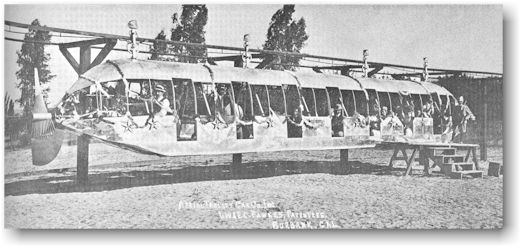
The six
months went by and only $38,000 had been raised. One of the opponents of the
public fund raising was J. W. Fawkes. In 1907, Fawkes had patented the first
monorail car in the United States and wanted to run a monorail line from
Burbank to Tropico (South Glendale). He had built one 56-passenger monorail car
and a short line on his ranch on Olive Avenue between Lake and Flower Streets.
Fawkes was unsuccessful in securing the right to build his line, so the fund
raising progressed.
The Burbank
committee received a 60-day extension of the time agreement. Two days before
the deadline, the fund still lacked $10,000. Ralph O. Church and Charles B. Fischer
drove all day in one of the valley's first automobiles and their destination
was San Diego. There they visited A. J. Stough who had large land holdings in
Burbank, and convinced him to contribute $8,000 to the fund. On their all-night
journey home, Church and Fischer stopped in Riverside. They routed out of bed
another man who had property in Burbank and they would not leave his home until
he had given them the remaining $2,000.
Citizens
disagreed over where the right-of-way should be. A member of the Board of
Trustees opposed the plan to locate the car line along Glenoaks Boulevard to
Scott Road through "people's vineyards." He said the vineyards would
be ruined and, besides, it would be a hundred years before anyone lived that
far from the business district. In spite of these protests, the selected
right-of-way for the Pacific Electric Railroad was from the end of the Glendale
line to Glenoaks Boulevard and along Glenoaks to Scott Road.
The first
car over the Pacific Electric tracks arrived in Burbank on September 6, 1911.
The Burbank Review ran a special edition advising all citizens that: "On
Wednesday, the first electric car running on a regular passenger-carrying
schedule left the Pacific Electric station at Sixth and Main Streets, Los Angeles,
for Burbank at 6:30 a.m. and the first car from Burbank to Los Angeles left at
6:20 a.m. the same day. Upon arrival of this car on its maiden trip, many
citizens gave evidence of their great joy by ringing bells and discharging
firearms. A big crowd of both men and women boarded the first car and rode to
Glendale and there changed to the second car coming from Los Angeles and rode
home again. Every face was an expression of happiness and satisfaction."
Looking up Olive Avenue on the day the first Pacific Electric car arrived from Los Angeles.
Before
September 6, 1911, Burbankers going to Los Angeles could get there by two daily
Southern Pacific trains from San Francisco and Santa Barbara or, the travelers
could take an automobile stage from the corner of Olive Avenue and San Fernando
Road to Broadway and Brand in Glendale and continue the trip to Los Angeles by
way of the Pacific Electric trolley. With the completion of the Pacific
Electric line, the Burbank Chamber of Commerce adopted the slogan, Burbank - 45
minutes from Broadway (L.A.). Since automobiles were scarce and a trip by auto
over unimproved San Fernando Road to Los Angeles took much longer than 45
minutes, most people who wanted to travel to Los Angeles before the
"Burbank Line" used horses and buggies. The P. E. cars saved these
people considerable time. From 1911 until 1955, many passengers used the
"red cars." The line was abandoned and the tracks removed in 1956.
On March 26,
1913, $70,000 in bonds was approved by the citizens of Burbank to be used by
the city to build a plant on Magnolia Boulevard to produce electricity and to drill
more water wells in the city. The people celebrated this achievement on July 4
of that year when visitors crowded the sides of San Fernando Road to watch
"the greatest automobile race ever known." Barney Oldfield, a famous
racing driver of that time, and 49 others raced from Los Angeles to Sacramento.
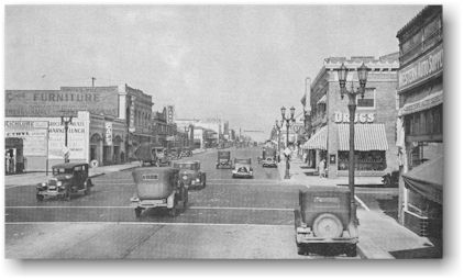
This picture of San Fernando Road between Angeleno and Olive Avenues shows a narrow macadam strip down the center. This was the only paved street in town. Other streets were dirt roads.
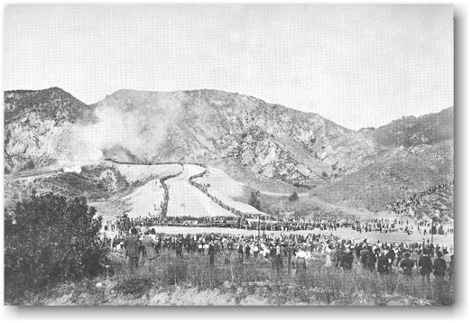
The city of
Los Angeles also had reason to celebrate in 1913. A great engineering
accomplishment, the Los Angeles Aqueduct - for which the citizens had voted a
$23,000,000 bond issue in 1907 - was finished. On November 5, 30,000 people
gathered to watch the first mountain waters from the Owens River Valley, 250
miles away, come plunging down the open aqueduct. Cannons were fired searing
the horses that had brought some of the people to this celebration. Many people
from Burbank traveled out San Fernando Road to the gathering at the
"cascades." The picture below shows the celebration at the
opening of the spillway.
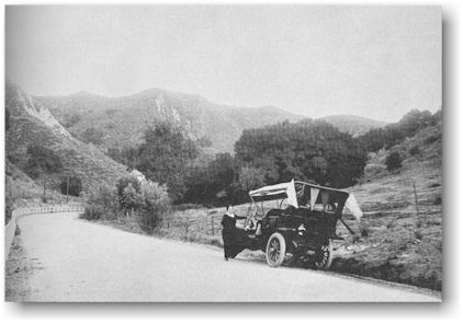
Enroute to the aqueduct celebration, 1913.
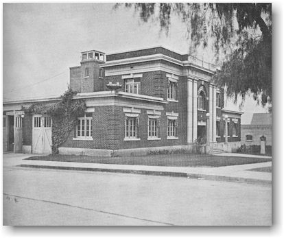
By 1916, a
city hall had been built and Burbank had purchased its first fire truck. Fifteen
hundred people now lived in Burbank, triple the population of 1908. The City
Trustees moved their meetings from the “Brick Block” to the new city hall which
faced Olive Avenue and was located on the corner of Olive Avenue and Third
Street. The picture above was taken in 1927.
During World
War 1 (1917-1918), the boys and girls of Burbank Grammar School bought Liberty
Bonds. To promote the sale, a large sign hung in the main entrance of the
school, The World Must Be Made Safe For Democracy.
Another elementary
school was built in 1916 on the northwest corner of Magnolia Boulevard and
Third Street across the street from the grammar school. The school was for
children in the primary grades, and was later named the Luther Burbank School.
This building was converted to the school district's administration offices in
1941.
The
beginning of manufacturing and the passing of the agricultural era took place
in 1917. Ralph O. Church, Burbank's first city treasurer, read in his morning
paper that the Moreland Truck Company was planning to move its plant from Los
Angeles to Alhambra. Church called one of Burbank's most enthusiastic boosters,
Maurice Spazier, and told him the news. The two men immediately set out for the
Moreland plant in Los Angeles. They found Watt Moreland, head of the company,
ready to draw up an agreement to move to Alhambra. Church and Spazier offered
Moreland a suitable site for his factory - free of any cost to him. Moreland
stalled the Alhambra deal to look at the site in Burbank. The first site, at
Verdugo Avenue and Flower Street, was unsatisfactory. The offer was quickly
changed to a 25-acre tract on the corner of San Fernando Road and Alameda
Avenue owned by Henry Luttge, and $25,000 was raised to pay for the land.
Buildings were constructed and the truck company moved in. - Moreland trucks
traveling on the highways of this and many other countries of the world bore
the label "Made in Burbank."
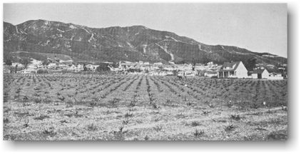
The factory
was surrounded by farms as shown in the picture on the following page. On the
side toward the business district there were acres of potatoes growing. Other
farmers raised fruits of various kinds, melons, and alfalfa.
Many years
later, after the Moreland Company stopped producing trucks, the building was
used by the Vega Aircraft Corporation. Still later, the Weston Biscuit Company
manufactured cookies at this location.
Another
factory opened shortly after the Moreland Truck plant. The Libby, McNeill and
Libby Canning Company took advantage of the nearness of Burbank to the Southern
Pacific Railroad and the fruits raised in the valley and built a canning
factory on Verdugo Avenue where the street crossed the railroad.
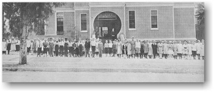
In 1919, a
modern building replaced the Burbank Grammar School. The Thomas A. Edison
School was built on San Fernando Road between Magnolia Boulevard and Palm
Avenue. This building was used as a school until the earthquake of 1933. For a
time after that it was used as an administration building. In 1941, the
administrative offices were moved across Magnolia Boulevard to the Luther
Burbank School building. The Edison School property was later sold, the
buildings torn down, and business structures were erected.
The Thomas A. Edison School in 1927.
The Burbank
Public Library, as a branch of the Los Angeles County Library, was started in
1913 through the efforts of the Burbank Chamber of Commerce. It was combined
with the "Library of the Brotherhood" and located in their rooms in
the Thompson Block at San Fernando Road and Olive Avenue. In 1918, the branch
was moved to the city hall where it remained for about six years, and was then
moved to the Thompson Building at San Fernando Road and Orange Grove Avenue. In
January, 1924, Mrs. Elizabeth Knox was appointed Burbank's first librarian and
the library was moved again, this time to 221 East Olive Avenue.
Another land
boom started in the early 1920's. A Hollywood real estate promoter, Ben W.
Marks, bought a part of the Stough Ranch property in 1919. He planned to
develop a subdivision that would equal the Wilshire Boulevard area. He donated
the present site of McCambridge Park to the city for a municipal center and
hoped that the southern branch of the University of California (U.C.L.A.) would
be located in the Benmar Hills residential area. The once-favored Burbank site
was rejected when the Janss Investment Company donated the land in what is now
Westwood to the University and U.C.L.A. was built in Westwood. Marks' promotion
began to collapse and ended in financial disaster, defaulted bonds, and
confused property title claims. The "Campus" sign in the picture on
the next page was a reminder of the ill-fated Benmar Hills development which
had sought to bring the University of California to Burbank. The picture was
probably taken in the late 1920's.
Many small
real estate promotions were attempted about this time and tracts such as
"Schomp Heights, Burbank's Beauty Subdivision" began replacing old
time ranches.
Burbank
citizens, both men and women, organized service clubs. The first was a Kiwanis
chapter formed in 1922. The following year, the first women's service club, the
Burbank Business and Professional Women's Club, was organized and met at the
Santa Rosa Hotel. One of this club's projects was planting trees on park
property at the corner of Hollywood Way and Vanowen Street, now the site of the
Lockheed facility. Earlier, the American Legion Post 150 and troops of Boy
Scouts and Campfire Girls had been formed.
In the Fall
of 1924, the clubhouse of the Woman's Club of Burbank was completed at 705 East
Olive Avenue. The picture below was taken in 1927. The club had been organized
in 1916 when the members of the Lavender Salad Club and the Ladies' Auxiliary
of the Chamber of Commerce joined forces. There were no restaurants in Burbank
and the Lavender Salad Club's nine members had been serving lunches for businessmen
at the Santa Rosa Hotel since 1909. The ladies wore white lawn aprons trimmed
with lavender flowers and lavender lace beading, hence their colorful name.
Membership dues in the Woman's Club in 1916 were $1 a year and luncheons at
meetings cost $.25. Among the charter members were Mrs. Ralph Church, Mrs.
George Wood, Mrs. E. A. Fischer, Mrs. Charles B. Fischer, Mrs. Frank S. Roach,
Mrs. B. W. Redding, and Mrs. G. Ray Pendell. The Junior Woman's Club was
organized in 1926 for daughters of the Woman's Club members.
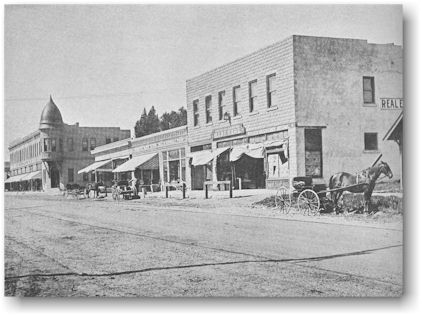
The Burbank
business district had expanded both north and south from the corner of San
Fernando Road and Olive Avenue by 1924. On the west side of San Fernando Road,
business buildings stretched form Verdugo Avenue to Cypress Avenue and on the
east side, the buildings extended to Palm Avenue.
In the
period between 1920 and 1930, many new industries located in Burbank. First
National Studio (now Warner Brothers) moved to California to take advantage of
the climate and built a studio on Olive Avenue. Production companies used city
streets for many outdoor shots. The people of Burbank enjoyed seeing themselves
on the screen but were unhappy because the railroad depot was used so often for
a "hick town" station.
Other firms
which came to Burbank were Cinecolor, Bendix Aviation, General Water Heater
Corporation, Empire China Company, Mission Glass Works, and the Andrew Jergens
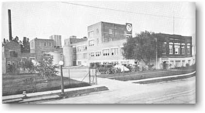
Company, makers of Woodbury Soap. The picture below shows the Jergens plant at
99 West Verdugo Avenue as it appeared in 1927.
The photo below is one of the first pictures of Burbank taken from an airplane in
1922. It shows the Jergens and Libby buildings at Verdugo Avenue and the
Southern Pacific tracks. The business district and school buildings on San
Fernando Road can also be seen. Most of the people lived above San Fernando
Road. Farms and vineyards surrounded the city.

A number of
other firms located in Burbank during the twenties, but many were business
failures. Among these were the American Aluminum Corporation and the Inner Tube
Company. Both businesses failed before they really got started leaving
disillusioned stockholders (most of whom were substantial Burbank citizens)
with no legal recourse.
Empire China
Company enjoyed a more or less precarious existence for several years before
having to close its doors because of a dispute among its stockholders.
About this
time, too, General Grease Company came into being and existed only long enough
to collect a considerable amount of money from unsuspecting Burbank citizens.
A number of
smaller concerns such as the Genevieve Jackson Dehydrating Company and a
garlic-processing factory also flourished for a while. Probably the only
industry that Burbank has ever asked to relocate its plant was the garlic
factory. But it is said that conditions got so bad "that garlic fumes
actually permeated nearly every clothes closet of every home in town. And
either the garlic factory had to go or Burbank stood to lose a sizeable portion
of her population. So the garlic factory moved!"
These firms,
however, abandoned buildings that later became the locations of other
industries which were successful.
Burbank was
gradually changing from a farming area to a city and began dropping its rural
ways. Municipal garbage pickup was authorized in 1920; outhouses were banned in
1922; and in April, 1923, the federal government officially recognized
Burbank's growth by dropping the village mail delivery classification and
substituting city postal delivery service.
The city
marshal's office was reorganized into a police department in 1923. Uniformed
police officers enforced traffic laws so efficiently that traffic fines often
exceeded the department's operating cost. The police department was noted for
its enforcement of Prohibition. In 1921, federal agents were assisted by local
officers in a raid on a still being operated by men from a neighboring
community.
In 1919, the
First Methodist Church broke ground for a new building at the corner of Olive
Avenue and Third Street and the building was dedicated in October, 1922. When a
new Methodist church was built on Glenoaks Boulevard in 1948, the building on
Olive was torn down.
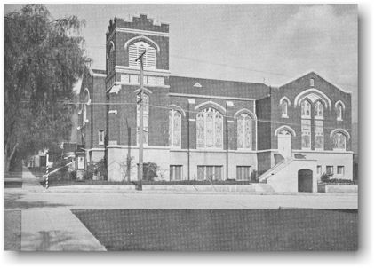
The First Methodist Church on Olive Avenue in 1927.
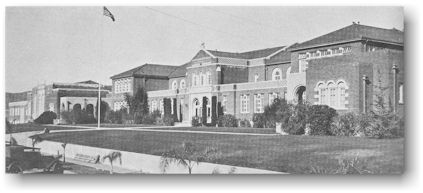
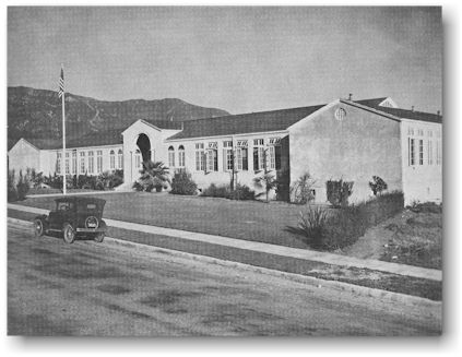
During the
year 1921-1922, Burbank High School was built at Third Street and Fairmount
Road. In September, 1922, the student body totaled 300 and the faculty had
twenty members. A library was added to the original building very shortly after
the school opened. By 1925, a swimming pool, shops, and tennis courts were
added to enrich the instructional program.

Two new
elementary schools were built in 1922-1923. Abraham Lincoln and Joaquin Miller
Schools first opened their doors in March, 1923. These schools were located in
population centers away from the business district. Each school consisted of
two classrooms and one kindergarten plus an office and a teachers' room. These
two schools remained as primary schools for a few years. The addition of Grades
4, 5, and 6 necessitated two new classrooms for each building in 1927. Further
growth made additions necessary at three other times.
On Sunday,
March 4, 1923, a 450-acre tract opened in the Magnolia Park area. Earl L.
White, a dairy operator, aimed his real estate promotion at the middle income
group. White cleared the property with mule teams, graded and improved the
streets, built some houses, and began a sales campaign. Two hundred fifty
salesmen took prospective buyers around to view lots and houses. Mr. White knew
the value of a connecting link from Burbank to Cahuenga Pass and asked for help
from the city. When he was unable to get the help, he cleared the underbrush
through Dark Canyon and graded the street. This "connecting link" is
now Barham Boulevard and Hollywood Way.
Earl L.
White built and sold Magnolia Park's first plat of 147 homes. His company
handled $18,000,000 worth of real estate transactions in seven years by
attracting customers with street dances and spectacular airplane stunts.
Mr. White
also built a shopping center at the corner of Hollywood Way and Magnolia
Boulevard. It included a bank, sub post office, daily newspaper, radio station,
dry goods store, beauty and barber shop, shoe store, hardware store, electric
shop, and even a mortuary. The newspaper, The Burbank Tribune, had more
paid subscribers than any other daily in the valley at that time. Publication
of this newspaper stopped in the early days of the depression.
KELW (Kall
Earl L. White) started as a 1,000 watt radio station in 1927. The Hearst
newspaper syndicate bought the station in 1935 and changed the call letters to
KEHE. In 1939, the station was purchased by Earle C. Anthony and became KECA.
In 1944, Mr. Anthony sold the station to the Blue Network. That same year the
Blue Network was changed to the American Broadcasting Company and the call
letters became KABC.
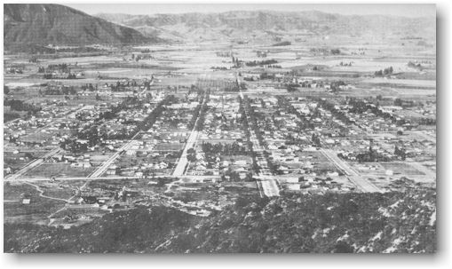
View of the valley, 1922, taken from the head of Olive Avenue before the valley was developed.
By 1929, over
3,500 homes had been built in the Magnolia Park area. The "Big
Depression" of the 1930's robbed Magnolia Park of its radio station and
daily newspaper, and stopped all real estate promotion. It was almost 10 years
before the area again boomed.
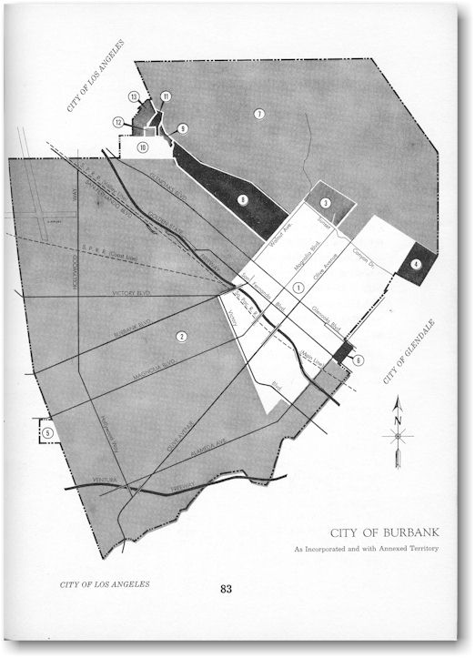
The city of
Burbank expanded its boundaries by annexation during the 1920's. The Valley
District which included nearly all of present day Magnolia Park had been added
to the original townsite in 1915. In 1922, the Thornton-Luttge District became
part of the city, followed by the Sherlock Drive District later that same year.
A small tract west of Clybourn Avenue between Magnolia Boulevard and Clark
Avenue called the Magnolia Park District was annexed in 1923, the Moreland
District in 1924, and the Sunset Canyon District in 1926. Since the 1920's the
largest addition to the city was the Benmar Hills annexation in 1948 and, as
shown on the map, Burbank realized several boundary changes during the 1950's.
Following is
the legend for the map below, which shows the territorial growth
of the city of Burbank:
Square Miles
1.) 2.59467
incorporation July 15, 1911
2.) 9.14
Valley District - Annexed April 19, 1915
3.) 0.14043
Thornton-Luttge District - Annexed March 29, 1922
4.) 0.10564
Snerlock Drive District - Annexed October 16, 1922
5.) 0.04477
Magnolia Park District - Annexed October 6, 1923
6.) 0.02884
Moreland District - Annexed March 10, 1924
7.) 4.23
Sunset Canyon District - Annexed January 18, 1926
8.) 0.446
Benmar Hills Addition - Annexed March 1, 1948
9.) 0.00867
McClure Addition - Annexed January 21, 1954
10.) 0.1266
Grandview Highlands - Annexed August 19, 1954
11.) 0.0189
Keswick Addition - Annexed August 16, 1955
12.) 0.0089
Horace Mann School Site - Annexed October 19, 1955
13.) 0.05715
Cabrini Addition - Annexed February 4, 1959
16.94589
Square Miles
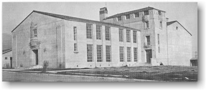
Burbank Junior High School, 1924.
In 1924, the
first unit of Burbank Junior High School was erected at the corner of Third
Street and Grinnell Drive. Since 1922, the John Muir Intermediate School, for
the seventh and eighth grades, had been using the old Burbank Union High School
building at San Fernando Road and Cypress Avenue. The 1909 building was gloomy
and well worn. The new building was the latest word in California educational
buildings with roomy classrooms, large sunny windows, and special rooms for
science, art, and home economics. The library was in the principal's office and
the principal watched over the fifty books that the library contained.
John Muir Junior High School, 1929.
In 1925, the
ninth grade was transferred from the high school to the new junior high and by
1929 the school had been enlarged. A cafeteria, an auditorium, shops, and a
gymnasium had been added. The gym was built on the site of the old Burbank
Union High School.
Burbank
Junior High School became John Muir Junior High School in 1928 after John
Burroughs Junior High had been built in the valley section of the city. After
the 1933 earthquake, the third floor art room at John Muir Junior High School
was removed and that school shared its classrooms with Burbank High School while
the earthquake damage to the high school's main building was being repaired.
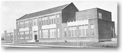
Burbank was
now growing rapidly. The schools had to keep pace. Bonds were voted in 1924 to
build George Washington, William McKinley, and Theodore Roosevelt Elementary
Schools. Each building had four classrooms when it opened in 1926. Roosevelt
School, pictured below in 1927, is, representative of the architecture of these
schools. In 1927-1928, the Ralph Waldo Emerson School, consisting of six
classrooms, a kindergarten, an auditorium, offices, and storage spaces was
built. Through the years, all of these schools have been enlarged and some have
been completely rehabilitated or rebuilt.
The Burbank
Union High School District and the Elementary City School District were united
in 1927 and became the Burbank City School District with a City Board of
Education and a City Superintendent of Schools. Then in 1928, the name of the
system was changed to the Burbank Unified School District.
Burbank's
population had grown enough by 1926 to meet the California requirement for
"Home Rule." A city must have more than 3,500 people in order to
prepare and adopt a local charter that gives that city supremacy in city
affairs, and exempts it from general state laws relating to municipal affairs.
The Burbank
electors chose fifteen freeholders (real estate owners) to prepare a charter.
Miss Octavia Lesueur is generally credited with doing the major portion of the
work of writing the charter. Other writers were J. H. Barnum, Roy Campbell, L. F.
Collins, A. C. Fillbach, Ray G. Ludlow, C. A. Thompson, J. D. Radcliff, Earl L.
White, Addison Sence, John Luttge, and Walter E. Lawrence. After eight months'
work, a charter was presented by the Board of Trustees to the voters. At a
special election on January 4, 1927, the voters approved replacing the trustees
with a city council-city manager type government. On January 13, the California
State Legislature approved the charter.
One of the
first actions of the City Council was to replace the volunteer fire department
with a regular department. Two branch fire stations were built in the valley
section.
By 1927,
Burbank had 1.25 miles of paved streets, 1,996 telephones had been installed,
and the number of water meters increased from 952 in 1921 to 3,900 in 1927.
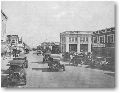
The picture
below shows Burbank in 1927, about the time its original city
charter was adopted. Compare this picture with the previous one.

In these
early years, there were no traffic signals in Burbank and many people drove Model-T
Fords. Pepper trees, planted by the Providencia Land Company, lined many of
Burbank's streets.
On April 19,
1927, a Park Board was established because of a controversy over the pepper
trees. Some Burbank citizens were concerned because anyone who wished could
remove trees with no thought of replacing them. Octavia Lesueur was elected
president of the Park Board and during her term of office more than 30,000
trees were planted or replaced in the parkways throughout the city.
Olive Avenue from below San Fernando Road, 1927.
The city had
also established a Playground Commission and a Recreation Commission. At first
the two groups operated separately, but eventually they consolidated as the
Burbank Park and Recreation Department. The department was given charge of all
parkways and recreational facilities.
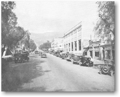
Many
businesses had been added to the San Fernando Road area by 1927. A theatre near
the corner of Angeleno Avenue showed "Leading Photoplays." Cars were
no longer able to angle park on San Fernando Road. Because of the traffic,
parallel parking had become necessary.
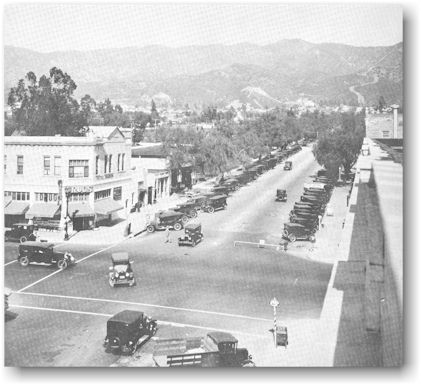
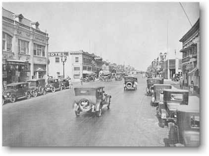
Above: Olive Avenue at San Fernando Road, 1927.
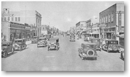
Above: Two scenes of San Fernando Road near Olive Avenue, 1927.
Above: San Fernando Road at Verdugo Avenue, 1927.
Above: San Fernando Road at Angeleno Avenue, 1927.
Above: The Empire China Company in 1927.
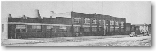
By 1927, the
Lockheed Aircraft Company had outgrown its Hollywood headquarters. Through one
of its major stockholders, Fred S. Keeler, also a stockholder in the Empire
China Company, Lockheed found ample space in a building partly occupied by the
Mission Glass Works at the corner of San Fernando Road and Empire Avenue. Miles
of farms, orchards, and vineyards surrounded the plant. In March, 1928, the
Lockheed Company occupied 20,000 square feet of working area at the corner of
Empire Avenue and San Fernando Road. The Burbank Review predicted a
future payroll of "as high as 200 men." Behind the new factory a
landing strip was cleared of sagebrush and tumbleweeds and leveled. Twice a
year the strip was graded to fill gopher holes and keep down weeds.
The company
prospered because the Lockheed planes set nearly every speed record of the
times. Charles Lindbergh, Wiley Post, Frank Hawks, and Amelia Earhart were some
of the famous pilots who purchased these planes. Wiley Post and Harold Gatty
made a trip around the world in 8 days, 15 hours, and 51 minutes. This was in
July, 1931. Other pilots used Lockheed planes to set both speed and altitude
records. Amelia Earhart, in her Lockheed Vega plane, was the first woman to fly
solo across the Atlantic Ocean. This was in May, 1932, and the flight took 15
hours and 18 minutes.
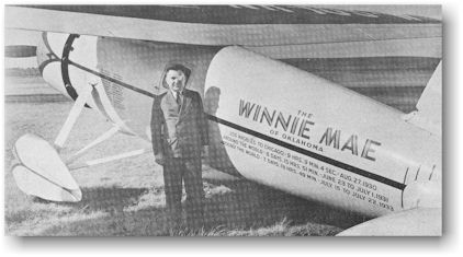
Wiley Post with his single-engined Lockheed Vega in 1933.
In July,
1929, the Detroit Aircraft Corporation, aspiring to become the "General
Motors of the Air," purchased 87 percent interest in Lockheed. The sale
was disastrous for Lockheed because with the stock market crash in October,
1929, and the depression that followed, the Lockheed branch of Detroit Aircraft
Corporation remained the only part of the organization making money. The
company took all the profits of Lockheed to try to keep the parent organization
alive. In October, 1931, the Lockheed branch followed Detroit Aircraft into
bankruptcy and the Title Insurance and Trust Company of Los Angeles became
receiver for the Lockheed unit.
On June 6,
1932, seven young men bid $40,000 for the assets of the bankrupt Lockheed
Aircraft Company. Robert E. Gross, Carl B. Squier, Lloyd C. Stearman, Walter T.
Varney, Cyril Chappellet, R. C. Walker, and Thomas P. Ryan III were the only
bidders for the company assets which included the Lockheed name, the design and
manufacturing rights to a series of plywood airplanes, and the experience and
service of a few men who were substantial contributors to aviation's
development. A two-story house north of the plant was used for the office and engineering
sections. Thus Lockheed Aircraft Corporation was born.
In the late
1920's, the Aeronautics Branch of the United States Department of Commerce
surveyed the entire Los Angeles area to determine the most favorable airport
location and recommended the Burbank area as the best from the standpoint of
weather, surrounding terrain, and closeness to populated districts.
Spurred by
this report, valley civic leaders spearheaded by the Burbank Chamber of
Commerce and the Burbank Review began a drive for an airport early in
1929, and took options on the land. Surveys showed a half million-dollar bond
issue was needed to buy land, grade it, and get the airport started. Such a
bond issue was considered politically and economically impossible for a town
with only a few thousand persons.
United
Aircraft and Transport Corporation became interested, conducted surveys that
confirmed the Department of Commerce report, and took over the options. In
1929, they began construction of the “first $1 million airport in the United
States.” They purchased 240 acres of land at the corner of Vanowen Street and
Hollywood Way, and the city of Burbank donated a section of Winona Street to
provide required runway space. The runways were constructed by discing the
ground and sprinkling it seven times with heavy oil. A 2% inch thick pliable
surface gave a proper cushion for early planes, which were not equipped with
modern shock absorbers. Two hangars and a pretentious terminal building were
the first structures at the airport. The field was still a vineyard with a dry
riverbed running through it. United Airport was dedicated with a big three-day
military and civilian air show that began on Memorial Day, 1930.
Hamilton
Standard Propeller and Northrop Aircraft Corporation built plants at the field.
Pacific Air Transport was the only commercial line using the field and their
San Diego-Seattle run landed one flight a day. The plane was a single-engined
Boeing 40B that carried four passengers and a pilot.
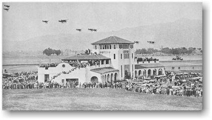
United Airport dedication ceremonies, May 30, 1930.
United
Airports Company of California, Ltd., purchased the airport in 1934 and
developed it to the largest in the Los Angeles area. The field became known as
Union Air Terminal.
By 1930,
16,662 people called Burbank their home. Most of them lived close to the
business district or in the Magnolia Park area. Many vineyards were still
maintained both north and south of the developed area above San Fernando Road.
The last of the grapevines gave way to housing in the 1940's.
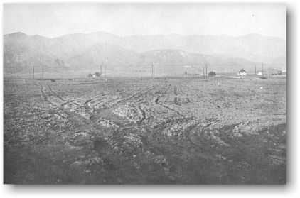
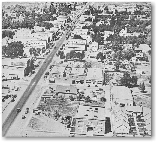
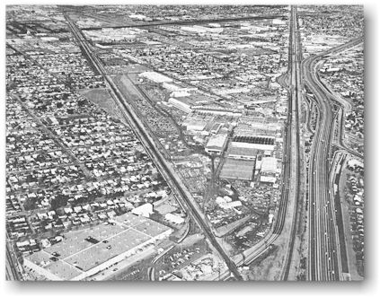
Above: The valley area in 1929 showing United Airport in the distance. The angled street along the bottom of the picture is Olive Avenue.
Above: An aerial view showing the air terminal and surrounding area in 1935. The street that runs across the center of the picture is San Fernando Road.
Burbank
citizens traded their skills as carpenters, barbers, or professional people for
food and services. The city used people who were unemployed to pave streets,
build flood control channels, or to cut fire breaks in the hills. The downward
trend in employment continued into 1935 at which time city relief programs listed
1,608 heads of families as unemployed.
The Lockheed
Company, which incorporated in 1933, grew in contrast to other businesses.
Within a year's time following incorporation, 289,741 shares of stock were
sold. A new all metal, twin-ruddered, two-engined plane was developed called
the Electra. It carried ten passengers, two pilots, and a full cargo of mail or
express, and sold for $36,000, a very low price for a multiengine airplane. The
price was soon raised to $55, 000, which was still the lowest cost for any
plane of its class. A smaller version of the Electra, known as the Electra Jr.,
was designed and built, and, at the request of the Air Corps, Lockheed modified
the standard Electra into the first successful pressurized substratosphere
airplane. This model was called the XC-35.
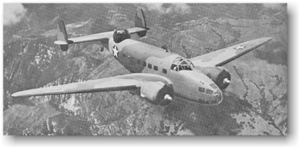
Above: Lockheed Hudson bomber.
Before World
War II started in Europe, Lockheed planes modified from a Model 14 Super
Electra design were sold to the British government, beginning in 1938. Nearly
3,000 of these "Hudson" bombers were built by the end of World War
II. In 1937, the United States Army Air Corps asked the aircraft industry to
submit designs for a pursuit plane capable of reaching an altitude of 20,000
feet in six minutes and a top speed of 360 miles per hour. Lockheed engineers
submitted the design for the P-38 Lightning, destined to become one of the most
widely known and used fighter planes in World War II.
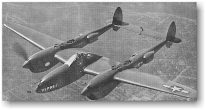
Above: P-38 Lightning fighter.
Employment
at Lockheed jumped to 7,300 in September, 1939, and continued to increase. The
Vega Aircraft Corporation, a subsidiary of Lockheed, bought property at the
corner of Hollywood Way and Empire Avenue next to the air terminal. Lockheed
expanded its facility at Empire Avenue and Victory Place and bought a
distillery on San Fernando Road to be converted into a factory to build the P-38's.
While
Lockheed was building war planes, its engineers were anticipating the future
peacetime need for luxury-class, four-engined commercial transports. When World
War 11 ended and commercial planes could again be manufactured, Lockheed was
prepared to meet the need with the new, distinctively designed Constellation.
In spite of
the depression, the Burbank City Council optimistically believed that the city
would one day need more electricity than the Public Works Department could
provide. In 1931, a contract was signed with the Bureau of Reclamation for 25
million kilowatt-hours per year of electricity from Hoover Dam. This
electricity was on a take-or-pay basis be- cause the city was using only 13
million kilowatt-hours per year at that time. Three years later, the entire
city electrical system was changed from 50 cycles to 60 cycles. The change was
necessary to use the power from Hoover Dam. A program to rewire or replace all
the city's electrical motors, at a cost of about $150,000, was undertaken. The
conversion was extended all the way down to electric clocks, and city workers
went to homes to adjust higher priced clocks or simply to supply new clocks for
lower priced models.

Also in 1931
a new city seal was adopted which replaced the "cantaloupe" seal, and
reflected the city as an urban rather than a rural community.
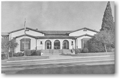
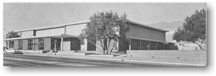
The city
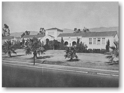
built a new main library building on Olive Avenue near Glenoaks Boulevard in
1935. The county library service operated the library until 1938 when the
Burbank Public Library became a city department. The picture above was taken in
the 1960’s.
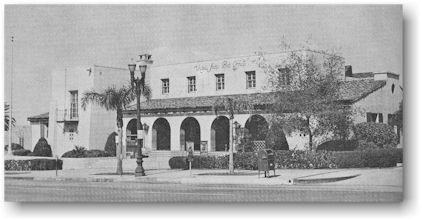
The main
Burbank Post Office found a permanent home at 135 East Olive Avenue in 1938.
The United States government purchased the Santa Rosa Hotel (the Burbank Villa)
which was built in 1889, from the heirs of Mrs. May Clarke who owned the hotel
and the surrounding property. The hotel was demolished and the post office
building was erected.
The first
post office, in 1887, was located in a red barn on Orange Grove Avenue which
was also used for a grocery store and a boarding house for workmen during
construction work on the Burbank Villa. After the barn location, the post
office made many moves. The second site was on San Fernando Road between Olive
Avenue and Orange Grove Avenue. The post office next moved to the "Brick
Block" on the northeast corner of Olive Avenue and San Fernando Road and
then to the southwest corner of San Fernando Road and Orange Grove Avenue. One
of the more permanent homes of the post office was on the north side of
Angeleno Avenue between San Fernando Road and First Street where it remained
for 17 years.
Besides
changing locations, the post office itself changed very dramatically. It
started as a fourth class office with one person, a lady, operating it. People
called for their mail at the grocery store. After fourteen years, it became a
third class office with a postmaster and a clerk, and provided both residential
and business deliveries. As time passed and the population of Burbank
increased, more carriers were added. In 1925, the post office attained a first
class status.
The First
National Studio, later Warner Brothers, was joined in Burbank by other movie
companies. In 1935, the Columbia Studios built a "ranch" on the site
which had been the Burbank Motion Picture Stables at Hollywood Way between
Verdugo Avenue and Oak Street. A special zone variance allowed the
"shooting" of pictures any time day or night.
Walt Disney
Productions outgrew their Los Angeles studio and, in 1939, purchased 51 acres
on Buena Vista Street between Alameda Avenue and Riverside Drive. The
completion of the Disney studios late that year reinforced Burbank's position
as the world's motion picture producing center.
Above: First National Studios with the Lasky Ranch in the distance. Inset shows Warner Brothers.
Above: Walt Disney Productions, Inc.
The growth
of Lockheed and the coming of the studios and other industries to Burbank drew
people to the area. Burbank's population more than doubled from 1930 to 1940.
The census of 1930 listed 16,662 people, and 34,337 inhabitants were counted in
1940.
By the late
1930's, the United Airports Company of California, Ltd. was making efforts to
sell Union Air Terminal. To prevent the loss of this major airport to the
Burbank and Los Angeles area, and to provide a good field for flying and
testing World War II planes then being built in increasing numbers, Lockheed
Aircraft Corporation purchased the field in 1940. It formed a subsidiary,
Lockheed Air Terminal, Inc., to operate it.
The original
240 acres were increased to 550 acres and the facilities were expanded to 45
major buildings, including 17 hangars, all of which represented an investment
of many millions of dollars.
After
December 7, 1941, when the United States became involved in World War II,
Japanese nationals were sent to relocation camps. Some of these Japanese
families had been operating vegetable farms and nurseries in Burbank. Their
farms were subdivided and houses were built on the land. This completed the
city's evolution from an agricultural to an industrial community.
After World
War II started, engineers at Lockheed developed planes for the armed services
and for our wartime allies and employment rapidly rose to 80,800 men and women.
Planes built in Burbank made outstanding contributions to the war effort and
included not only such famous names as Hudson and P-38, but also the PV-1,
Ventura, and, after the war ended, the P-80 Shooting Star jet fighters. Vega
Aircraft Corporation, the Lockheed subsidiary, pooled its skills with the
Boeing and Douglas companies to build 12,731 B-17 bombers.
Lockheed
subcontracted some of the assembly work to other plants in the area. Camouflage
changed the appearance of Lockheed from the air. Lockheed and other war
production factories were covered with canvas painted to look like fields,
hills, houses, and trees. From the air it appeared that a new "subdivision"
had replaced the Lockheed plant. The picture above shows the terminal in 1945.
Some evidence of camouflage can be seen.
The
population of Burbank during the next ten years doubled again. By 1950, 78,224
people lived in the city. This population explosion affected all of the city
departments. A new city hall, constructed across Olive Avenue from the original
one, was completed in 1943. The police department was enlarged and the fire
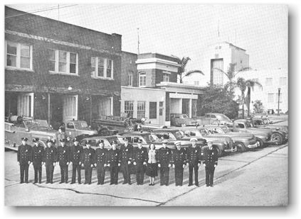
department added new stations. The picture opposite shows the personnel and equipment
of the fire department in February, 1950, with the new city hall in the
background.
The post
office added two classified stations. The first was in Magnolia Park and the
second was on Empire Avenue and was known as the Lockheed Station. The second
one was later moved to Glenoaks Boulevard near Scott Road and called the
Glenoaks Station. Still called the Glenoaks Station, this post office was
recently relocated on San Fernando Boulevard and Grismer Avenue. Three
sub-stations were located in local markets: the Toluca Mart, Bill's Ranch
Market, and King Cole Market. In 1966, the sub-station was moved from the
Toluca Mart to a newly developed shopping center on Pass Avenue.
In 1947,
helicopter service was added to the truck and railroad handling of mail. Post
office trucks carried airmail to and from a helicopter landing site and from
there it was flown to the Municipal Airport, later called the Los Angeles
International Airport.
The Burbank
Post Office first used the heliport at Lockheed Air Terminal, then a landing
site near Lake Street in Burbank, and later transferred to the Glendale
heliport.
The quantity
of airmail increased steadily and Burbank was able to obtain only partial
helicopter service. This service was discontinued on July 31, 1966, when
Burbank began a more active participation in the ZIP Code program (Zone
Improvement Plan). As a part of this plan, the city of Van Nuys was named the
sectional sorting center for the Burbank area and, as of August 1, 1966, all
mail from Burbank was sent by trucks to Van Nuys and then directly, by the
fastest transportation available, to the sectional center closest to its
destination.
The school
population increased by 4,000 from 1940 to 1950. Eight new elementary schools
were built: Thomas A. Edison, 1940; Bret Harte, 1941; Henry M. Mingay, 1945;
Central, 1946; Thomas Jefferson, Monterey Avenue, and Robert Louis Stevenson,
1948; and Benjamin Franklin in 1950. John Burroughs Junior High School became a
senior high school in 1948 and two new junior high schools, Luther Burbank and
David Starr Jordan, were opened in September of that year.
During World
War II, Mickey Mouse and all the Walt Disney characters also "went to
war." The Disney Studios produced training films for industry and the
armed services. Cartoons promoted the sale of war bonds. One of them, “The New
Spirit,” was a sensation. It was a film to show why income taxes should be paid
without delay. It was estimated that 37 per cent of all Americans paid their
taxes almost immediately after seeing the picture. (This was before income
taxes were withheld from paychecks.) Units from every branch of the armed
forces asked for, and received without charge, mythical mascot designs. Disney
artists contributed more than 200 designs.
One of the
San Fernando Valley's major hospitals opened in 1944. The Sisters of Charity
built St. Joseph's Hospital using contributions from private citizens and
businesses.
The Burbank
Symphony Orchestra made its debut on July 17, 1944. Verdugo Park, with the
city's first municipal swim stadium, opened in 1948.
In 1946, the
second city seal was replaced by the present seal which was described as
follows in Section I of Ordinance No. 799, "The following described Seal
is hereby adopted for the City of Burbank and for the Police Court of the City
of Burbank, to wit: a seal oblong in form, with rounded corners, and which
shall have inscribed thereon a pictorial representation of an airplane,
factories and a moving picture reel with the words 'CITY OF BURBANK' inscribed
across the top of said seal immediately above the wings of the airplane and
with the word 'PROGRESS' inscribed at the bottom of said seal immediately under
the moving picture reel, and further with the words 'INCORPORATED JULY 8, 1911'
inscribed below the factories pictured therein." Disney Studios designed
the third Burbank City Seal.
When World
War II ended in 1945, war production ceased in Burbank, but the wartime
prosperity was not followed by a depression. Although Lockheed received
cancellations of more than $1 billion in orders, and employment dwindled to
35,000 at the Burbank facilities, no mass layoffs were necessary. Lockheed had prepared for peace with the
development of the Constellation, and production of the P-80 jet fighter plane
continued into peacetime years.
The progress
of the city of Burbank suffered a setback in December, 1946, when the major
airlines transferred nine-tenths of their operations to the newly opened
Municipal Airport in Los Angeles ending the position of leadership held by
Lockheed Air Terminal as the main commercial air passenger field in Southern
California.
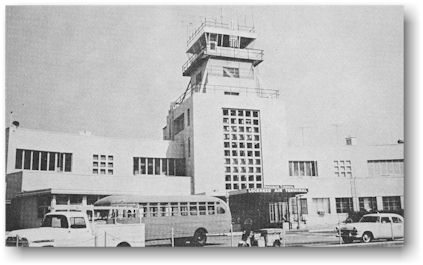
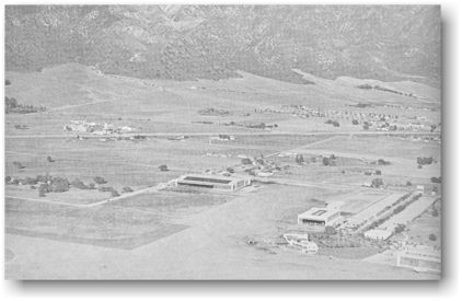
Above: Lockheed Air Terminal in 1960.
Many persons
believed this shift of airline flights would doom the Lockheed Terminal. After
a short period of adjustment, however, the growth of the airport continued due
to the steady increase in air travel and air freight shipments of all kinds,
the growth of public demand for low cost, air coach type travel, and the
convenient location of the terminal.
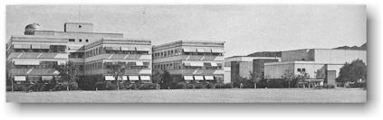
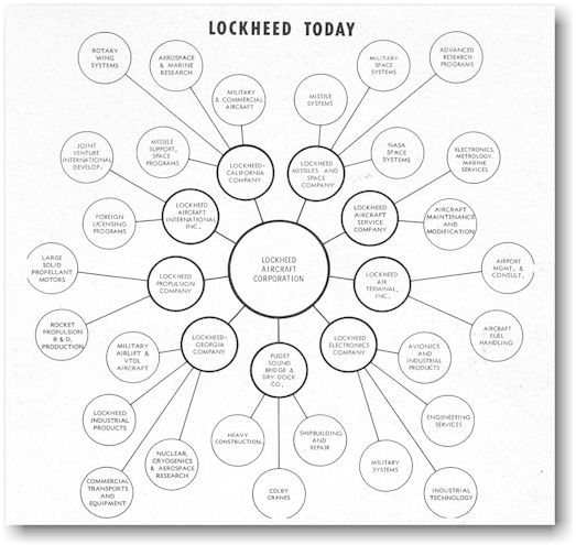
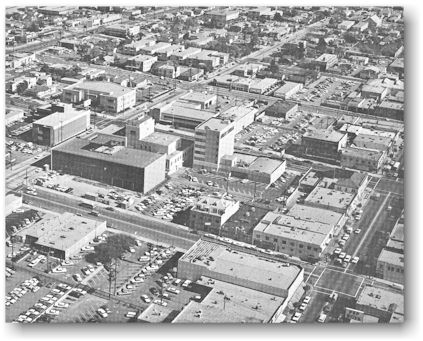
In 1966,
Lockheed Air Terminal ranked as one of the busiest and largest privately owned
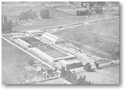
commercial airports in the United States, and the Lockheed company had grown
and diversified until, as shown in the chart below, its geographically
dispersed facilities covered 22 million square feet, and assets totaled more
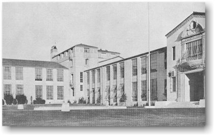
than $650 million. Employment was approximately 88,000.
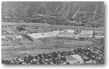
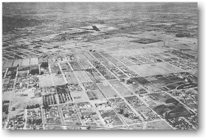
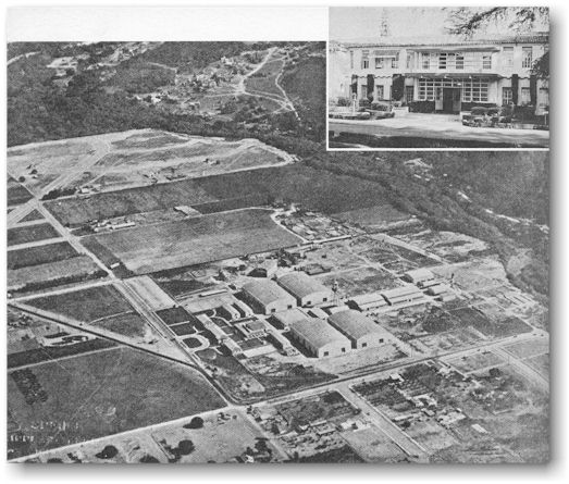
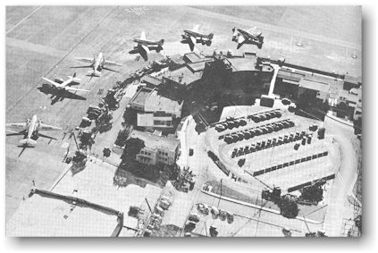
Above: Aerial view taken in 1966 showing the two main facilities of the Lockheed-California Company and the air terminal.
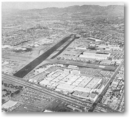
Above: Aerial view taken in 1966 showing the two main facilities of the Lockheed-California Company and the air terminal.
Real estate
values in Burbank increased when wartime building restrictions ended. Potential
homebuyers, trying to find a place to live in the city, created a postwar
building boom. Large housing tracts consumed all vacant areas. Over 7,000 new
residents moved into Burbank from 1945 to 1950.
The
population increased by approximately 12,000 from 1950 to 1960, to reach a
total of 90,155. Growth of the city's industries increased. The electronic, assembly,
and other light manufacturing industries thrived as advanced technology was
applied to consumer products and to the needs of a government concerned with
rocketry and atomic age defense.
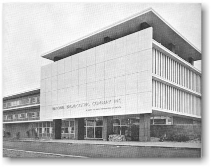
The National
Broadcasting Company bought property at Olive Avenue and Alameda Street in
1951. The site became the location of NBC's color television studios. Later,
when more studio facilities were added, all the local NBC programs originated
in Burbank.
United
Productions of America, a film cartooning studio, opened in the Toluca Lake
area and joined the motion picture community of Warner Brothers, Columbia
Pictures, Disney Studios, and Technicolor.
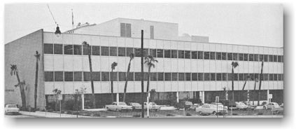
Early in the
1950's the Burbank County Courts Building, under construction in the picture
above, was built on the site formerly occupied by the First Methodist Church on
the corner of Olive Avenue and Third Street. The Superior and Municipal Courts
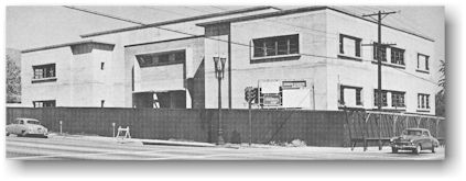
and an office of the county clerk were located in the building.
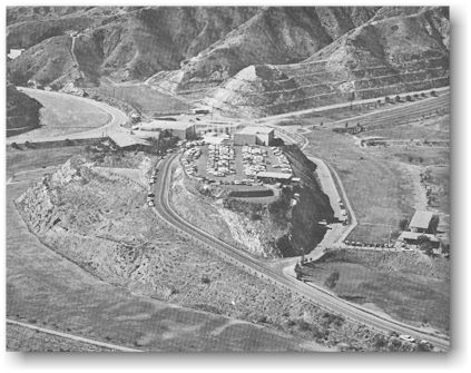
Starlight
Bowl opened in Stough Park in the summer of 1950. The bowl became the setting
for many cultural and other community activities.
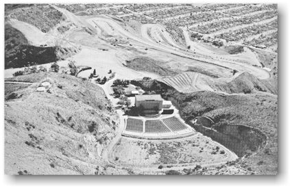
Above: Starlight Bowl with the cut-and-fill area in the background.
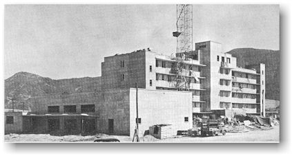
In 1953, St.
Joseph's Hospital opened a new $2 million wing which made it the valley's
leading medical center with a capacity of 250 beds.
Two more
elementary schools were opened during the 1950's: Providencia in 1952, and
Horace Mann in 1955. A new John Muir Junior High School was completed on
Kenneth Road in 1952. The Adult Education Center moved its offices from Burbank
High School to the former Muir building on Grinnell Drive.
During the
early 1950's, when syndicated crime appeared to be getting a foothold in
Burbank, the city realized a "time of troubles." Concerned citizens
created the Burbank Citizens Crime Prevention Committee and requested the
California Crime Commission to investigate.
The report
of the commission shocked the people of the city and repercussions resulted in
the resignation of the chief of police. By the time the investigations were
completed some members of the City Council had resigned, and one councilman who
refused to resign, was recalled by the citizens. (The Burbank Citizens Crime
Prevention Committee still exists as a reminder of the interest of the people
in fair and honest local government practices.)
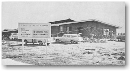
New City
Council members were elected and a new city manager was appointed. This group
encouraged the formation of a citizen's advisory committee on capital
improvements to assist them in a survey of community needs. Representatives
from nearly every civic organization were among the committee members who met
on July 29, 1954. This group proposed a 10-year capital improvement program
with an expected cost of more than $10 million!
Burbank
voters approved $5,565,000 in bonds to finance the program. Additional funds
came from the annual revenues of the city government and a half-cent increase
in the city sales tax.
By 1961,
most of the major projects of the program were completed. A new main fire
station had been built on Olive Avenue between Third Street and Glenoaks
Boulevard. Two new fire stations were built in other parts of the city. The old
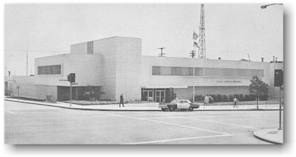
city hall was remodeled for use by the police department. Later, the old
building was torn down and replaced by a new one, the Police Services Building.
In addition to housing the various divisions of the Burbank Police Department
this building also housed a 12,500 square foot Emergency Operations Center for
the coordination of activities during a natural disaster or national emergency.
McCambridge Park became a major recreation center. Three overpasses bridging
the Golden State Freeway and the railroad tracks were built at Olive Avenue,
Magnolia Boulevard, and Burbank Boulevard. In the picture above the Olive and
Magnolia overpasses were complete and the Burbank Boulevard overpass was under
construction. DeBell Golf Course was constructed in the foothills adjacent to
Stough Park between Walnut Avenue and Harvard Road, becoming the first course
in the city since the early 1930's.


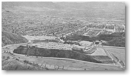
Above: In the picture above, the flood control channel can be seen parallel to the Golden State Freeway. To the left of the channel, in the lower half of the picture, is the Public Works Department and between Olive Avenue and Magnolia Boulevard the Public Service Department and steam plant can be seen.
Since 1961,
additional capital improvement projects have been built. Flood control
facilities were completed and a new main library building was opened on
Glenoaks Boulevard. A clubhouse and community center were built atop a knoll at
DeBell Golf Course. The Municipal Services Building, next to the city hall on
Third Street, and the water reclamation plant were completed in 1966. These
last two projects were financed through an additional $2 million in bonds voted
in February, 1963. All of these improvements have been the result of careful
planning of citizens who were actively interested in the growth and welfare of
the city.
Burbank, a
prosperous city of over 90,000 citizens, was born during the Southern
California land boom of the 1880’s when thousands of Americans came west during
the railroad rate war between the Southern Pacific and the Santa Fe. The
newcomers so completely Americanized the little town that Burbank's Indian and
Spanish heritage has survived only in street names. Almost completely forgotten
are the city's first inhabitants, nomadic Indians of the Shoshonean language
group who lived in wickiups, were noted basketweavers, and spoke the Cahueg-na
dialect.
Perhaps the
most lasting mark made on the area by the Spanish was San Fernando Road.
Although surrounded by twentieth century civilization, it still appears to
follow the route of the old road that linked the San Fernando and San Gabriel
missions.
Burbank
plans for the future.
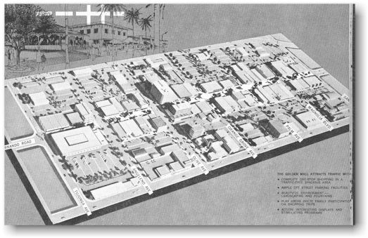
Above: The Golden Mall (click here for a dedicated page)
A six-block,
traffic-free "Golden" Mall has been scheduled for construction during
1967. The area will encompass the present downtown Burbank on San Fernando Road
from Tujunga Avenue to San Jose Avenue. This undertaking has been intelligently
designed for pleasurable shopping and browsing in a relaxed and attractive
atmosphere.
Bibliography
Brief
History of Burbank, California. Burbank: Burbank Chamber of Commerce, 1961.
Of Men and
Stars, A History of Lockheed Aircraft Corporation, Chapters I-IX. Burbank: Lockheed Air-
craft Corporation, 1957-1958.
Ranchos de
Los Santos, The Story of Burbank. Burbank: The Burbank Branch of the Security Trust and Savings
Bank, 1927.
Robinson, W.
W. Panorama, A Picture History of Southern California. Los
Angeles: Title Insurance and Trust Company, 1953.
Rolle,
Andrew F. and John Gaines. The Golden State, A History of California.
New York: Thomas Y. Crowell Company, 1965.
The Story of
Burbank from Her Eventful Pioneer Days. Burbank: The Magnolia Park Chamber of Commerce, 1954.
Williams,
Mabel Young. California, A History. Sacramento: California State
Department of Education, 1965.
Your Burbank
Home. Burbank:
Burbank Merchant’s Association, 1928.
Acknowledgments
In addition
to the booklets and leaflets found in the bibliography, help of inestimable
value was received from the following individuals who provided material and
pictures or who assisted in the writing and editing: Mr. Clyde Simpson,
Security First National Bank; Mr. Les Strout, Burbank Chamber of Commerce; Mr.
Tony Frank, Burbank Chamber of Commerce; Mr. Headlee Blatterman, Chief Engineer
KFI; Mr. Gordon Stanton, Lockheed Air Terminal; Mr. Phillip A. Juergens,
Lockheed Aircraft Corporation; Mrs. Grace Reis, Lockheed Aircraft Corporation;
Mr. Ronald Lockmann, Graduate Student U.C.L.A.; Mr. Laurence Sprecher and Miss
Gladys Callahan, Office of the City Manager; Mrs. Norine Haskitt, Office of the
City Clerk; Mrs. Marguerite Fanning, Burbank Post Office; Dr. Harry O. Simmons,
Member of the Board of Education; Mrs. Edna Scribner; Mr. Howard Martin; Mrs.
Florence Edgerley; Mrs. G. Donald Modd; and the following people who are or
have been associated with the Burbank Unified School District: Mrs. Delores
Palmer, Mrs. Barbara Handley, Mrs. Joan Horne, Mr. Donald Newcomer, Mr. Willard
Fredricksen, Mr. Gordon Risser, Mrs. Doris Ryeraft, Mr. Michael Kosteva, Mrs.
Louise Wickersham, Mr. Russell Wickersham.
D. P.
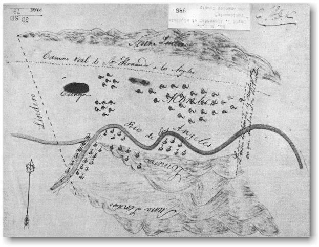
Above: Appendix - Diseno (grant map) of the Providencia Rancho field in the capitol at Monterey in 1842 by "David W. Alexander et al, Clmts."
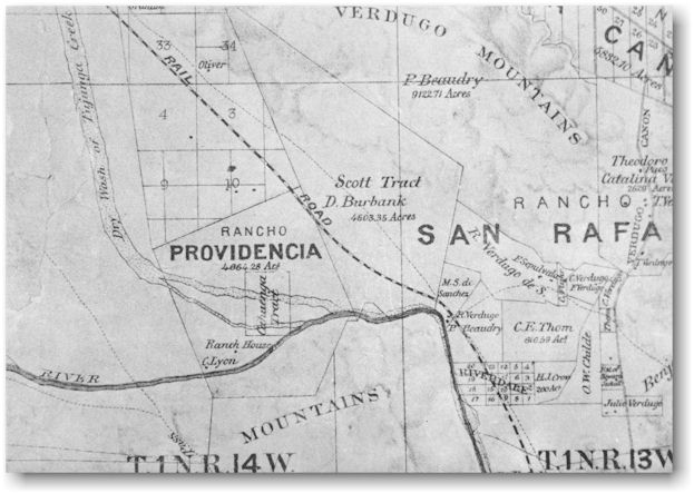
Above: Appendix - A portion of a map of Los Angeles County made by Wildy and Stahlberg in 1877.
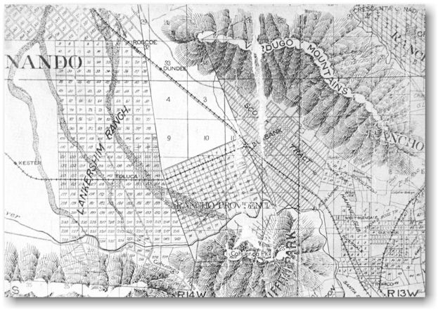
Above: Appendix - Official map of the county of Los Angeles, California, by E.T. Wright, 1898.

Above: Appendix - Burbank's main intersection at Olive Avenue and San Fernando Road in June, 1910, as shown on a Sanborn fire insurance map.